Northeast South Dakota under an “enhanced risk” of severe storm development Friday night (Audio)
July 16, 2020
Mike Tanner
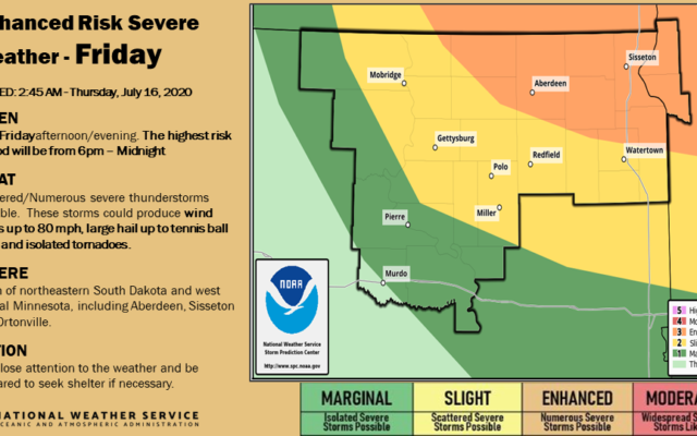
WATERTOWN, S.D.—The weather is unpredictable, and there’s no guarantee anything will develop, but the National Weather Service has placed northeast South Dakota under an “enhanced risk” (orange shaded area) of severe storm development tomorrow (Friday) night.
National Weather Service forecaster Mike Connolly says that threat will be preceded by a return of hot, humid weather…
Connolly says it’s that heat and humidity that could be the trigger point for severe storm development…
Connolly says the main threats will be damaging winds and hail, and a smaller risk of tornado development.